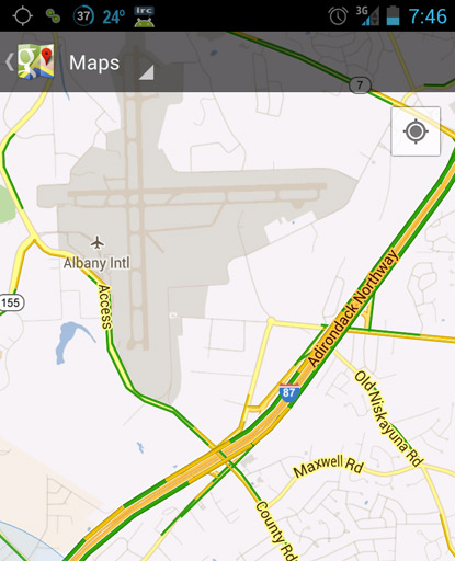
I live in a snowy area. Road conditions can get bad really quick. I’ve noticed that Google Maps’ live traffic information is a gateway to gauge road conditions. Green lines would mean likely plowed areas while yellow and red lines mean cars are slowing down because of poor conditions. I suppose there’s a chance it could be actual traffic but when you know the weather is bad, it’s far more likely to show yellow and red lines because of road conditions.
I live in a snowy area. Road conditions can get bad really quick. I’ve noticed that Google Maps’ live traffic information is a gateway to gauge road conditions. Green lines would mean likely plowed areas while yellow and red lines mean cars are slowing down because of poor conditions. I suppose there’s a chance it could be actual traffic but when you know the weather is bad, it’s far more likely to show yellow and red lines because of road conditions.